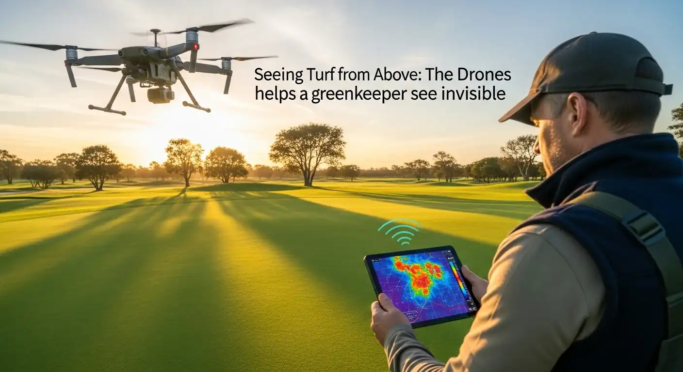
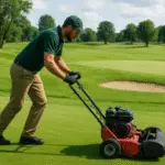
Greenkeeping has always been about observation. Walking the course early in the morning, noticing subtle colour changes, feeling firmness underfoot, and reading how turf responds to weather and traffic. In recent years, however, greenkeepers have gained a new perspective—one that comes from above.
Drone and aerial turf monitoring is no longer a novelty in 2026. It has become a valuable scientific tool that helps greenkeepers understand turf systems in ways that are impossible from ground level alone. Used correctly, drones do not replace daily course walks. They enhance them.
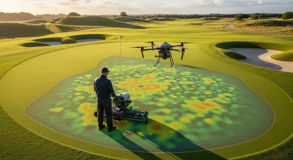
Aerial monitoring allows greenkeepers to see patterns that are otherwise invisible. From the ground, a green may look healthy. From the air, early stress lines, drainage issues, or uneven growth can suddenly become obvious. This wider view turns small details into meaningful data.
Seeing the Invisible
Aerial monitoring allows greenkeepers to see patterns that are otherwise invisible. From the ground, a green may look healthy. From the air, early stress lines, drainage issues, or uneven growth can suddenly become obvious. This wider view turns small details into meaningful data.
One of the most important scientific contributions of drone technology is early stress detection. Modern drones can carry multispectral and thermal cameras that measure how turf reflects light or releases heat. Healthy turf reflects light differently from stressed turf, even before visual symptoms appear. This means greenkeepers can identify problem areas days or even weeks earlier than traditional inspection allows.
Proactive Management Strategies
Early detection changes everything. Instead of reacting to visible damage, greenkeepers can adjust irrigation, nutrition, or traffic management before turf declines. This preventive approach reduces stress accumulation and often avoids the need for aggressive interventions later in the season.
Water management is another area where drones provide powerful insight. Aerial images quickly reveal dry spots, overwatered zones, and uneven irrigation coverage. On large fairways or complex greens, these patterns are difficult to detect from the ground. From above, they become clear and measurable.
Thermal and Drainage Insights
Thermal imaging adds another layer of understanding. Turf temperature rises when plants are under water stress or root function is impaired. By mapping canopy temperature across a course, greenkeepers can fine-tune irrigation schedules and identify areas where soil conditions restrict water uptake, even if moisture levels appear sufficient.
Drones also help evaluate drainage performance. After heavy rain, aerial monitoring shows how water moves across surfaces, where it pools, and which areas dry slowly. This information supports better decisions about drainage improvements, aeration strategies, and surface modifications. Instead of relying on memory or rough estimates, greenkeepers work with precise visual evidence.
Monitoring Traffic and Long-Term Trends
Traffic management benefits as well. Drone images reveal wear patterns around greens, tees, walk-off areas, and frequently used routes. Over time, these images help identify chronic stress zones caused by foot traffic, maintenance equipment, or tournament play. With this data, greenkeepers can rotate access points, adjust mowing lines, or reinforce vulnerable areas before damage becomes severe.
From a scientific perspective, drones support long-term data collection. Repeated flights over the same areas allow comparisons between weeks, months, and seasons. This helps evaluate the effectiveness of management decisions. Did a change in fertiliser strategy improve uniformity? Did new irrigation settings reduce dry spots? Aerial data provides objective answers.
Communication and Future Integration
Importantly, drones also improve communication. Greenkeepers often struggle to explain complex turf issues to managers, committees, or members. Aerial images make problems visible and understandable. When decision-makers can clearly see stress patterns or drainage limitations, discussions become more productive and realistic.
Looking toward the future, drone technology is becoming increasingly integrated with data platforms and artificial intelligence. Automated image analysis can flag stress zones, track changes over time, and even suggest management actions. This does not remove human judgement. Instead, it supports it by processing large amounts of information quickly.
Professional Standards and Limitations
As regulations evolve, drone use in Europe continues to be refined and professionalised. Responsible operation, proper training, and respect for privacy are essential. In greenkeeping, drones are tools—not toys—and their value depends entirely on how thoughtfully they are used.
Despite their advantages, drones have limits. They cannot replace soil sampling, root inspection, or the tactile knowledge gained by walking the course. Aerial data must always be interpreted alongside ground truth. The most successful greenkeepers combine technology with experience, not one instead of the other.
A Higher Point of View
For turf enthusiasts, drones offer a new way to appreciate the complexity of course management. The beauty of a golf course is not accidental. It is the result of countless small decisions, many of which now rely on information gathered from the sky.
In the coming years, drones will likely become as common as moisture meters or weather stations. Their greatest strength lies not in high-tech imagery, but in perspective. By seeing turf from above, greenkeepers gain clarity, confidence, and the ability to act earlier and smarter. Greenkeeping has always been about understanding nature. Drone technology simply helps us see it more clearly—from a higher point of view.
Drones in Greenkeeping: Frequently Asked Questions
How do drones help identify turf stress before it’s visible?
Drones equipped with multispectral sensors measure light reflectance across various wavelengths. Healthy turf reflects high amounts of Near-Infrared (NIR) light, while stressed plants absorb more. By calculating indices like NDVI, greenkeepers can spot physiological decline days or weeks before the grass shows any yellowing or visual wilting.
Can drone monitoring replace manual course walks?
No. While drones provide a “big picture” perspective, they cannot replace “ground truth” inspections such as soil sampling, root depth analysis, or physical firmness checks. The most effective greenkeeping strategy in 2026 uses aerial data to guide and prioritize where manual inspections are most needed.
What are the main benefits of thermal imaging in greenkeeping?
Thermal imaging detects the surface temperature of the turf canopy. Since plants cool themselves through transpiration, a spike in temperature often indicates water stress, poor root function, or localized dry spots. This allows greenkeepers to apply precision irrigation only where it is needed, saving water and preventing over-saturation.
How do drones assist in golf course drainage management?
Drones capture high-resolution topographical data and post-storm imagery to reveal exactly where water pools and how it moves across the surface. This provides objective evidence for planning aeration, installing new drainage lines, or modifying surface levels, replacing guesswork with precise visual data.
I live where turf meets tech, science meets sod, and tradition meets tomorrow.
A curious mind with a passion for the ground beneath the game, this space is dedicated to exploring the innovations, breakthroughs, and sustainable practices that are reshaping golf courses worldwide.
From the latest advancements in grass genetics to the most innovative course management tools, I will highlight the ideas that help the industry grow smarter, play wiser, and think long-term for the planet.
The mission is simple: connect the dots between the lab and the fairway, transforming complex science and cutting-edge tech into clear, compelling stories.
Together, let’s make every course better—one groundbreaking story at a time.
Bonjour,
Je partage pleinement ton analyse. À mon sens, ces outils ont vocation à être intégrés de manière structurée dans nos protocoles de travail, notamment pour objectiver nos diagnostics et affiner nos prises de décision.
Le point qui reste à clarifier concerne le délai de traitement et de mise à disposition des données après le vol. Sans visibilité précise sur le temps nécessaire entre l’acquisition, le traitement et la restitution exploitable, il est difficile d’anticiper leur intégration opérationnelle dans nos plannings.
Ce paramètre conditionne directement la réactivité des actions correctives que nous pourrons mettre en place.
As-tu un retour ou des éléments plus précis sur ce délai de traitement ?
Merci pour ton partage d’idées
I translated your comment Francois
Hello,
I completely agree with your analysis. In my opinion, these tools should be integrated in a structured way into our work protocols, particularly to objectify our diagnoses and refine our decision-making.
The point that remains to be clarified concerns the processing and delivery time of the data after the flight. Without precise visibility on the time required between acquisition, processing, and usable delivery, it is difficult to anticipate their operational integration into our schedules.
This parameter directly influences the responsiveness of the corrective actions we can implement.
Do you have any feedback or more specific information on this processing time?
Thank you for sharing your ideas.
After the flight, the data is available immediately. You can review the visual results right away and make an initial analysis on the spot. You also keep and collect the data for further comparison and deeper analysis over time.
Some issues can be identified immediately, for example potential dry spots, stress areas, or visible disease symptoms. In other cases, the value comes from comparing collected data over time. By monitoring changes and identifying differences, you can detect developing problems much earlier than through human visual inspection alone.
The aerial perspective gives a much broader “big picture” view, allowing us to see variations across the whole area. Once a problem is identified, you can react accordingly whether it’s irrigation adjustment, targeted treatment, or further investigation of possible diseases.
Pingback: The Role of Technology in Modern Greenkeeping. 2026 Insight